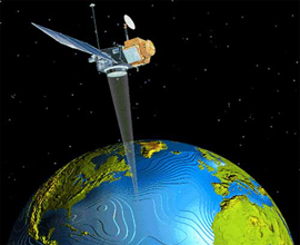
GIS Remote Sensing
The center has the capabilities to carry out constancy in Natural Resource management, environmental impact assessment, resource evaluation and site selection activities. The sophisticated computer system with Geo Information System (GIS) software's and Remote Sensing data analysis facilities are used for various projects involving spatial planning, digital database generation and system development. The broad areas of application, which the center can at present handle, are given below:
Resource mapping using Satellite Remote Sensing data (land, water, soil, forest, resources etc. )
Conventional survey using ground survey equipment
Environmental Impact Assessment and environmental status survey.
Soil and Water sample analysis.
Regional planning for the selection requirement of sites for agricultural, horticultural, -
pasture and fodder development.
Watershed management.
District/Block/Watershed resource database generation using GIS.
Resource evaluation, environmental monitoring using GIS.
Municipal and Urban Information System
Utility, Infrastructure and Communication network planning.
Urban area map, plan and scenario preparation using remote sensing data.
Map digitization using GIS / CADOVERLAY / R2V package.
City map / Guide map / Transit map preparation
Modelling and forecasting.
Software development.
Map updating with GPS system.
On-line Tracking of vehicles using tracking devices.
Besides the above , the center can generate following resource maps using Remote Sensing and GIS in any desired scale as per the specification of user.
Land-use
Hydro morphology
Forest / Vegetation
Agriculture (Crop type)
Plantation
Soil
Slope
Wasteland
Ground Water potential
Transport, Electricity, Water Supply Pipe Network & tracking.
Drainage
Contour extrapolation
Settlement
The GIS and various other software's are also used for the data integration and spatial data modelling to generate planning scenarios for scheme formulation and implementations.
Some of the aspects for which site selection can be done by GEO INFOTECH using several resource parameter like terrain attributes and lab. analysis data using GIS are:
Horticultural plantation
·Agro-horticulture
Horti-pasture
Agricultural plantation ( cashew, bamboo, rubber, sisal, etc. )
Forest plantation.
Fuel and fodder development
Pasture development / grass land development
Intensive agriculture though ground water exploration
Agro-forestry
Double cropping
Areas for urban and industrial development.
Areas for infrastructure development.
Silvi-culture
Pisci-culture
Cash crop development (groundnut, cotton, sugarcane, tobacco, sunflower, mustard etc. )
Water source targeting like WHS, bore well, tube well, irrigation well, spring, tank, MIP, etc.
Tracking vehicles on-line on the map with terrain heights.
|